schwartz_grid_lookup
given a lat/lon coordinate, this DeGAUSS container returns a
site_indexand asitecode, which are values specifying the nearest “grid” centroid point for the Schwartz spatiotemporal pollutant models
DeGAUSS example call
docker run --rm -v $PWD:/tmp degauss/schwartz_grid_lookup:0.4.1 my_address_file_geocoded.csv
geomarker methods
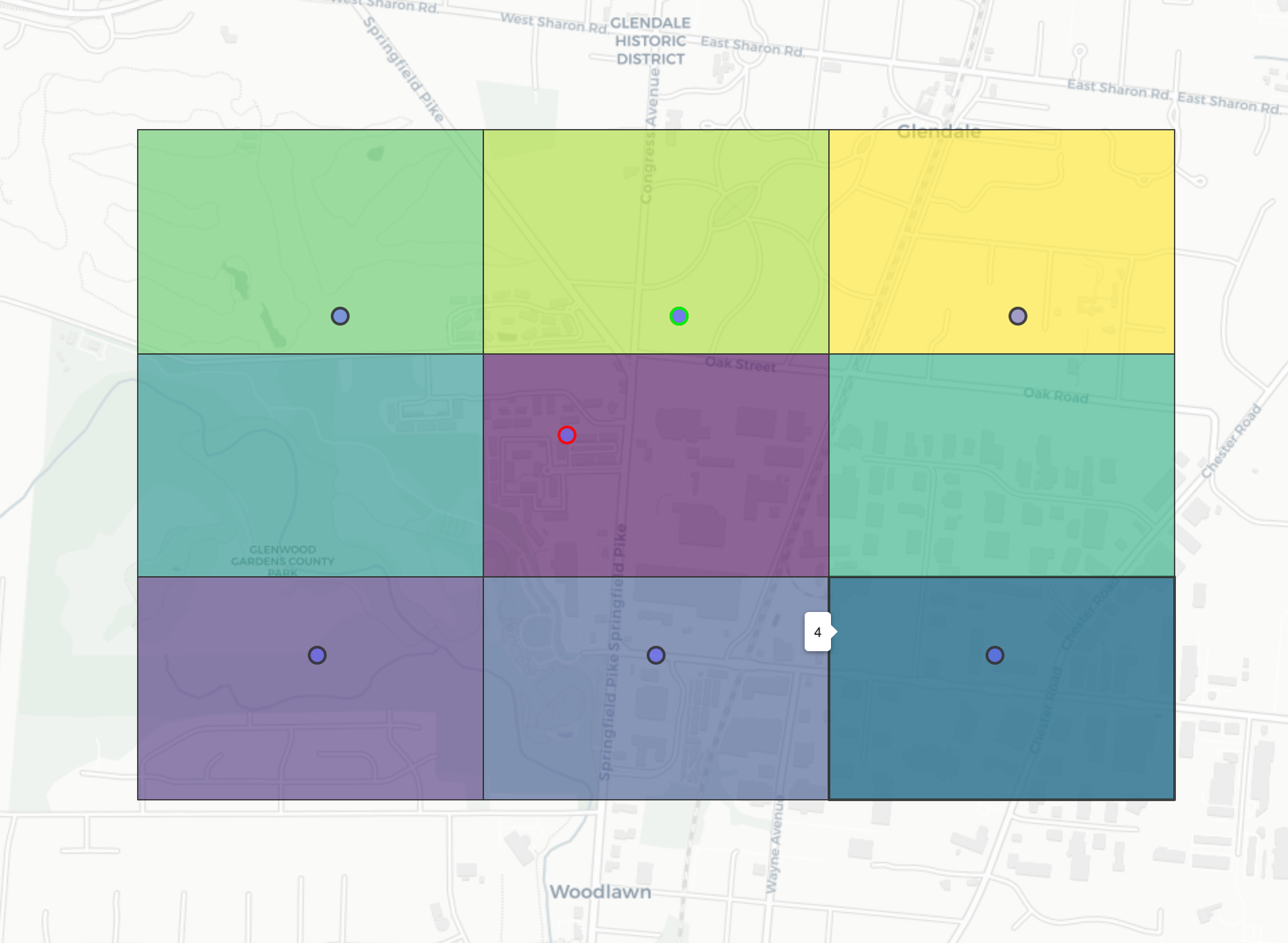
- the red dot below is the query point
- its surrounding box is what is was geohashed to (precision = 6)
- h2 geohashes are used to quickly determine nearby points; this also provides an index to download and extract spatiotemporal exposure estimates (see more details here: https://s2geometry.io/)
- neighboring boxes are added
- schwartz “grid” points that are geohashed within these boxes are extracted
- the index of the point closest to the query point, based on the great circle distance, is returned (highlighted in green)

geomarker data
- script relies on
s3://geomarker/schwartz/schwartz_grid_geohashed.qs, which is made by running01_geohash_schwartz_grid.Rons3://geomarker/schwartz/USGrid_Sites_1km_20200618.csv

