greenspace 

![]()
Using
If my_address_file_geocoded.csv is a file in the current working directory with coordinate columns named lat and lon, then the DeGAUSS command:
docker run --rm -v $PWD:/tmp ghcr.io/degauss-org/greenspace:0.3.1 my_address_file_geocoded.csv
will produce my_address_file_geocoded_greenspace_0.3.1.csv with added columns:
evi_500: average enhanced vegetation index within a 500 meter buffer radiusevi_1500: average enhanced vegetation index within a 1500 meter buffer radiusevi_2500: average enhanced vegetation index within a 2500 meter buffer radius
Geomarker Methods
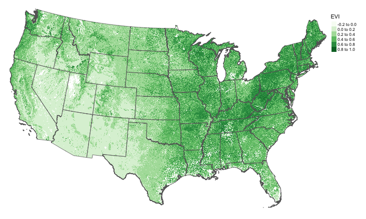
The Enhanced Vegetation Index (EVI) is a measure of greenness that ranges from -0.2 to 1, with higher values corresponding to more vegetation.
A cloud-free composite EVI raster at a resolution of 250 × 250 m was created by assembling individual images collected via remote sensing between June 10 and June 25, 2018.
Geomarker Data
-
To create the EVI raster, individual tiles were downloaded from the LP DAAC MOD13Q1 product and combined using the
{MODIS}R package. Then the raster was clipped and masked to the contiguous United States boundaries. -
The raster file needed to build this container is stored as a versioned GitHub release asset.
DeGAUSS Details
For detailed documentation on DeGAUSS, including general usage and installation, please see the DeGAUSS homepage.