roads 

![]()
Using
If my_address_file_geocoded.csv is a file in the current working directory with coordinate columns named lat and lon, then the DeGAUSS command:
docker run --rm -v $PWD:/tmp ghcr.io/degauss-org/roads:0.2.3 my_address_file_geocoded.csv
will produce my_address_file_geocoded_roads_0.2.3_400m_buffer.csv with added columns:
dist_to_1100: distance (meters) to the nearest S1100 roaddist_to_1200: distance (meters) to the nearest S1200 roadlength_1100: length (meters) of S1100 roads within a 400 m bufferlength_1200: length (meters) of S1200 roads within a 400 m buffer
Optional Argument
The default buffer radius for length of roads is 400 meters, but can be changed by supplying an optional argument to the degauss command. For example,
docker run --rm -v $PWD:/tmp ghcr.io/degauss-org/roads:0.2.2 my_address_file_geocoded.csv 800
will produce my_address_file_geocoded_roads_0.2.2_800m_buffer.csv, and length_1100 and length_1200 will be the lengths within an 800 m buffer.
Geomarker Methods
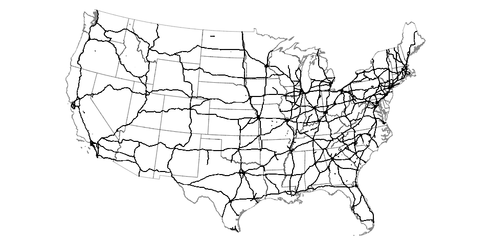
This container uses 2018 S1100 and S1200 roads, as defined by the U.S. Census Bureau.
| Road Type | Road Type Code | General Description | U.S. Census Definition |
|---|---|---|---|
| Primary | S1100 | interstates and freeways | generally divided, limited-access highways within the Federal interstate highway system or under state management; distinguished by the presence of interchanges and are accessible by ramps and may include some toll highways |
| Secondary | S1200 | arterial roads and state highways | main arteries, usually in the U.S. highway, state highway, or county highway system; have one or more lanes of traffic in each direction, may or may not be divided, and usually have at-grade intersections with many other roads and driveways |
The map below shows all features defined as “S1100” in the MAF/TIGER database.
Geomarker Data
-
2018 S1100 roadway shapefiles were downloaded using
tigris. -
2018 S1200 roadway shapefiles were downloaded directed from the U.S. Census Bureau using the bash script in this repository.
-
Road shapefiles are stored as versioned GitHub release assets
DeGAUSS Details
For detailed documentation on DeGAUSS, including general usage and installation, please see the DeGAUSS homepage.